Digital map treasures

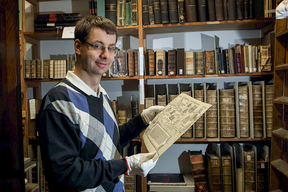
In 2017, employees at the University and State Library made a unique discovery when inventorying their collection of maps. They stumbled upon a map fragment depicting various scenes from the Bible, which were assigned to the relevant towns, rivers and mountains in the Holy Land. It belonged to a twelve-part work created by the 16th-century Dutch artist Herman van Borculo. At the time it was unearthed in Halle, only two other parts had been known to exist around the world, including one in the British Library in London. “I was overwhelmed by press enquiries at the time,” recalls Martin Scheuplein, head of the ULB map collection. Thanks to the sensation surrounding the find, he was informed about a further fragment in private ownership, so there are now four documented parts of the map. He explains that the British Library has the ambitious plan of putting the pieces together one day on a fully virtual platform. The ULB is in a very good position to realise the project: The fragment is one of the maps that have been digitalised and made available online as part of a project launched in 2021. The quality is much higher than a simple photograph, allowing viewers to zoom in very close to the historical material.
The ULB’s entire collection comprises around 100,000 map sheets. 17,500 maps are from the period before 1850, including 428 hand-drawn plans. Some of them – the first 1,000 specimens – can now be found and viewed online via the ULB repository (share_it) and in the library catalogue. “We’re receiving a lot of enquiries not only from local historians, but also international researchers, some of whom were looking for old places that can only be found on our maps,” says Scheuplein. They are now able to simply browse the ULB’s digital collections when conducting their initial research. This has been facilitated by funding from the Federal Government Commissioner for Media and Culture as part of the “Neustart Kultur” programme.

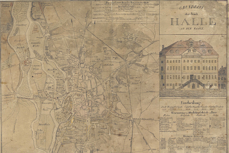
One focus of the online collection is the history of Central Germany: The digital copies include numerous mining maps from Mansfelder Land and the Harz Mountains, as well as maps of Halle, Magdeburg, Dessau or Wernigerode. Some of the city maps date as far back as the 18th century – the oldest map of Halle is from the year 1729. There are also a large number of war maps, battle plans and fortification layouts. They open up entire worlds for us to discover and explore, says Dr Julia Knödler, who manages the historical collections in which the maps are housed. She illustrates her point with two maps of Halle from the years 1820 and 1905. In 1820, a shooting range was mapped in the place where the two ULB buildings are located today on August Bebel Strasse in the northern section of the city centre. 85 years later, the buildings still existed but one of them still belonged to the mining authority. “You can spend hours browsing the online collection and trace the urban development,” says Knödler. For example, the effects of industrialisation are reflected by the emergence of new city districts: The modern-day Paulusviertel in the north of the city had been planned at the end of the 19th century and some parts had already been developed by 1905. Knödler adds that the maps are not only interesting for geologists and historians, but also for people from many other disciplines – even linguists. Landscape architects are using the maps to reconstruct historical parks and carry out various renaturation projects – and there have even been seemingly strange requests in the past… One person even wanted to use a city map from Lower Saxony as a tattoo template.
The ULB has also noted an enormous interest in maps from the “MENA region”, which comprises the Middle East and North Africa (including the Caucasus and Central Asia). This is the second focal point of the digitalisation project. For over 20 years, the ULB has been collecting materials from that region as part of a specialist information service funded by the Deutsche Forschungsgemeinschaft (DFG, German Research Foundation). Scheuplein refers to a recent debate on Twitter about one of the ULB’s digitalised maps from the area of present-day Iran dated 1650. “The community pondered the contents of the map,” says Scheuplein – including mistakes such as a lake that had been mapped incorrectly at the time. This is giving rise to a sort of citizen science, whereby the materials provided by the ULB are being analysed by amateur enthusiasts. “And this can result in completely new research projects”.
The digitalisation work was no mean feat, says Knödler – and not just because the maps are not stored exclusively at the main location. Some of the specimens had to be mended by restorers. “Many of them had been kept folded,” explains Knödler – that wouldn’t have looked very nice in the digitalised copy. Some of the maps therefore had to be treated and laid flat in a humidity chamber. Layers of dust were also removed using special sponges. “But it was worth it,” says Knödler. It is worth pointing out that the original copy of the largest map that is now accessible online measured 186 x 122 cm – too big for the ULB’s largest scanner, which can handle anything up to DIN A0 formats. It had to be scanned in several parts and was then painstakingly put back together on the computer. It is another map of the Holy Land: a map of Jerusalem dating back to 1874.
Dr. Julia Knödler
University and State Library Saxony-Anhalt
Telephone +49 345 55-22158
Mail julia.knoedler@bibliothek.uni-halle.de
Martin Scheuplein
University and State Library Saxony-Anhalt
Telephone +49 345 55-22176
Mail martin.scheuplein@bibliothek.uni-halle.de
